Advanced Spatial Intelligence & Perception
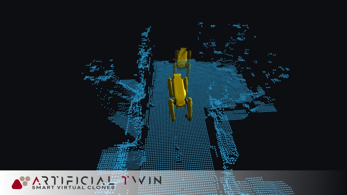
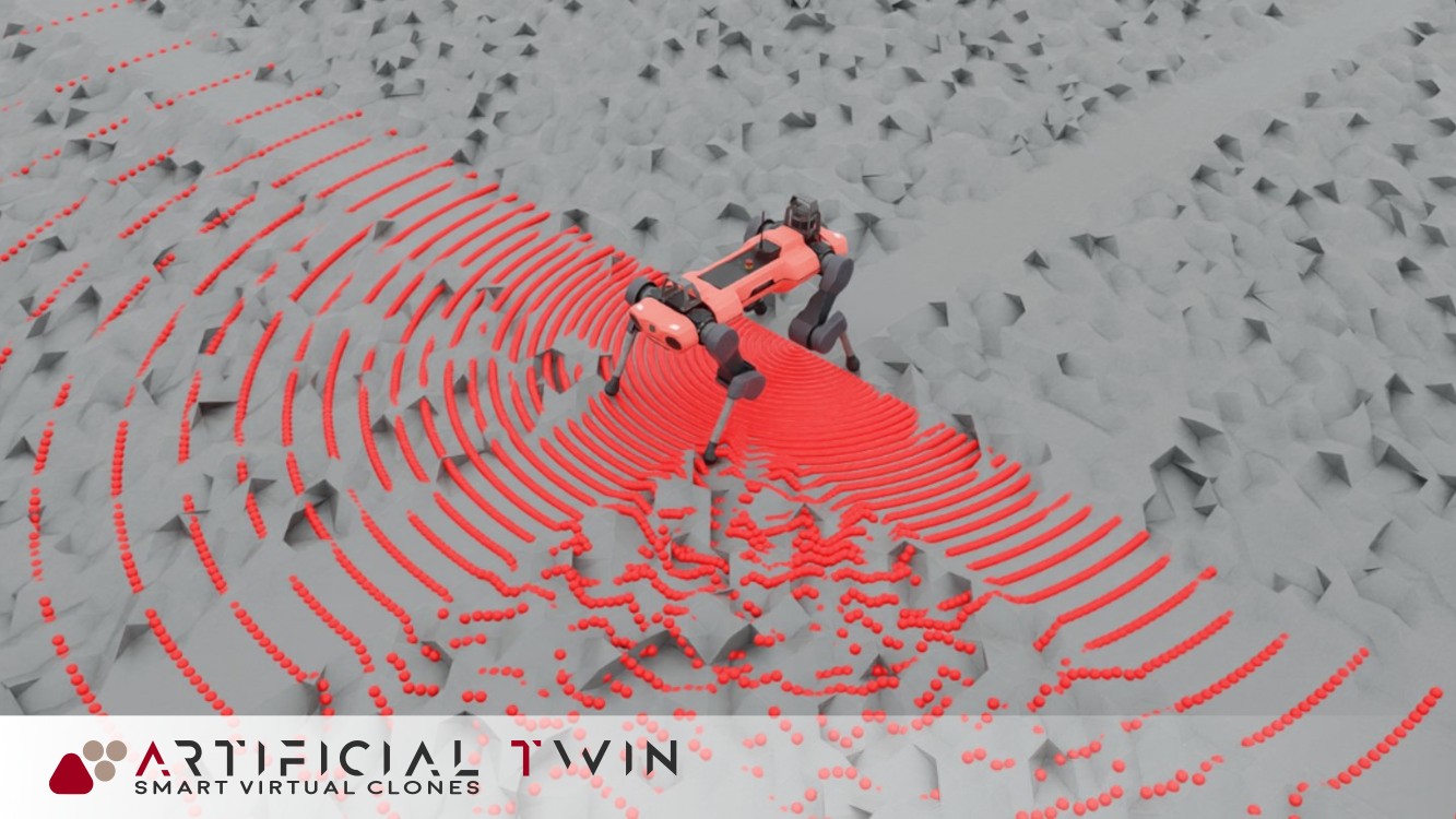
- LiDAR and sensor fusion preprocessing: Apply voxel filtering, denoising, and outlier removal to unify data from heterogeneous sensors.
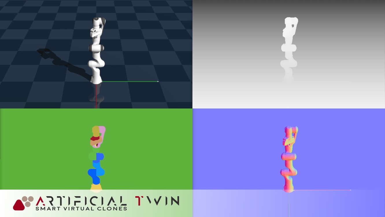
- Spatial feature extraction: Compute local geometric properties like normals, curvature, and roughness to support downstream tasks.
- Skeletonization and scene graph construction: Extract structural priors and semantic hierarchies to build interpretable 3D scene representations.
- Robotics, autonomous navigation, and smart infrastructure: Enable perception stacks that interpret and interact with complex 3D worlds.
- Integration with SLAM and 3D mapping systems: Enhance map quality and localization by plugging into existing SLAM pipelines and datasets.
CoGe provides a modular foundation for spatial AI, allowing teams to rapidly experiment with perception strategies across simulation and reality. Its optimized geometry kernels are designed for both batch processing and real-time loop execution.
3D File Handling & Processing
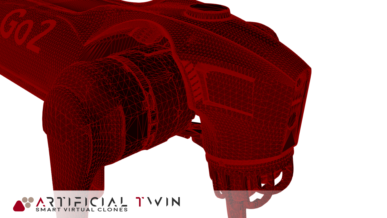
- STL, OBJ, STEP, IGES, BREP, OFF, PLY support: Read, write, and interconvert industry-standard mesh and CAD file formats for design, analysis, and simulation workflows.
- Boolean operations (NURBS + polygonal): Perform precise union, intersection, and subtraction on both curved surfaces and discrete meshes.
- CAD file repair and healing: Automatically detect and fix topological errors, missing surfaces, or bad geometries in imported models.
- In-browser/mobile 3D viewer with tools: Render, annotate, slice, and inspect 3D geometries interactively, accessible across devices with no install required.
CoGe streamlines the entire 3D asset pipeline, from raw model ingestion to processing and visualization, eliminating friction between CAD, simulation, and rendering systems. Whether working with clean BREP surfaces or messy triangle soups, CoGe ensures geometric consistency and usability across domains.
Point Cloud & Point Set Processing
- Surface reconstruction (Poisson, RBF, scale-space): Generate watertight meshes or smooth surfaces from raw, noisy point clouds using advanced interpolation and approximation methods.
- Classification, segmentation, noise filtering: Extract semantic structure and remove spurious data from unstructured scans for downstream tasks like modeling or navigation.
- Meshing from unstructured point sets: Convert unordered or partial point data into usable triangle meshes for rendering, simulation, or CAD alignment.
- Compatible with LiDAR and depth sensors: Ingest data from terrestrial, aerial, or embedded 3D sensors, ideal for robotics, AR/VR, and surveying applications.
CoGe bridges the gap between sparse sensor data and structured 3D geometry. Its point cloud pipeline supports real-time workflows while preserving accuracy, even in the presence of environmental noise, occlusions, or motion artifacts.
Mesh Generation & Optimization
- 2D/3D surface and volume meshing: Generate high-quality triangle or tetrahedral meshes suitable for simulation, rendering, or fabrication, from raw or processed geometry.
- Remeshing, refinement, simplification: Adapt mesh resolution dynamically to balance geometric detail, numerical stability, and performance across use cases.
- Hole filling, smoothing, deformation: Repair corrupted scans or optimize noisy geometry for downstream use in CAD, animation, or analysis workflows.
- Offsetting, hollowing, segmentation: Enable manufacturing-aware geometry operations such as shelling or part separation for additive/subtractive workflows.
CoGe provides end-to-end control over mesh fidelity, topology, and structure. Whether preparing inputs for finite element analysis or 3D printing, its optimization tools ensure watertight, clean, and semantically meaningful geometry.
Spatial Search & Topological Analysis
- AABB/KD-tree construction: Build efficient spatial acceleration structures for fast geometric queries in large-scale 3D scenes.
- Proximity queries (collision, neighbor search): Detect intersections, compute closest points, and analyze spatial relationships for navigation, simulation, and planning tasks.
- Spatial sorting and range searches: Organize geometry hierarchically to enable scalable, real-time queries across diverse resolutions and domains.
- Connectivity and topology-aware reasoning: Extract and reason about mesh connectivity, adjacency, and boundary loops for applications in shape analysis and structural modeling.
These tools form the backbone of intelligent geometric reasoning, allowing systems built on CoGe to perform precise spatial operations, accelerate agent-environment interaction, and support tasks like pathfinding, segmentation, and scene understanding.